|
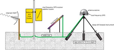
Schematic diagram of a Global Positioning System (GPS) station. Covering North America and Alaska , EarthScope's network of GPS stations will measure deformation across the plate boundary between the Pacific and North American plates.
Courtesy of EarthScope.
|